

MPIGI DISTRICT
At Independence in 1962, Mpigi was part of Buganda Kingdom. Following the abolition of kingdoms in 1967, Buganda was divided into 4 districts-East Mengo, West Mengo, Mubende and Masaka districts. Under the 1974 provincial Administration, West Mengo…

MASAKA
Location Masaka district is located about 37kms away from the Equator towards the south and lies between 0o- 25o South and 34o East, having an average altitude of 115m above sea level. The district is bordered by Sembabule in the North West, Mpigi…
LUWERO DISTRICT
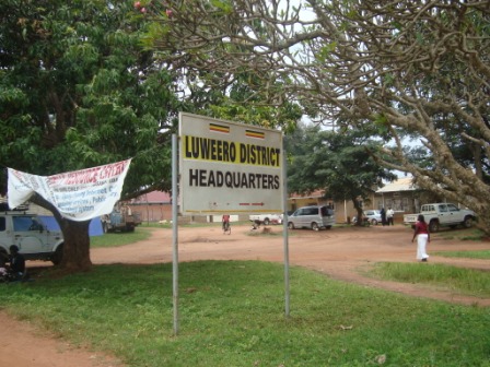
Location The District Lies amid Latitude 2 Equator and 2 north, and between longitude 32 and 33 east. It is bordered byNakasongola Districts in the North, Mukono District in the East and Mpigi District in the South. Luwero was the site of a brutal…

KIBOGA DISTRICT
Kiboga district was formed in 1991. It is situated in central region, bordered by Hoima and Masindi districts to the north, Luwero to the East, Mubende district to the south and Kibaale district to the West. Population The district has a population of…
KAYUNGA DISTRICT
Location Kayunga borders with 6 districts, including Apac in the north, Kamuli in the East, Mukono in the south, Luwero and Nakasongola in the west and Jinja. The district H.Q. is situated at Ntenjeru hill, 2km from Kayunga town. Kayunga district is…