Posted in
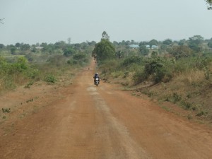
Katakwi District was created in 1997. It was formerly part of Soroti District. The 3 sub-counties which comprise Katakwi (Kapelebyong, Amuria and Usuk) belonged to Soroti until then.
LOCATION
It borders Moroto to the north-east, Nakapiripirit in the east, Kaberamaido in the south-west, Lira to the north-west and Soroti and Kumi in the south.
POPULATION
The district has over 307,032 people. 158,428 females and 148,604 Males.
MAIN LANGUAGE;
Ateso
ECONOMIC ACTIVITIES
Agriculture with main emphasis on food crops such as millet, potatoes, beans, and cassava. Cash crops include Cotton.
EDUCATION SERVICES
The district has a total of 160 primary schools with 157 government, 2 private and 1 community school. For secondary schools, the district has over 14 schools, 8 are government, 3 private and 3 community.
HEALTH SERVICES
The district has 15 Government dispensaries (II), 8 health centres (III) at county, 3 health centres (IV) at sub-district and no hospital. More so, it has 5 private/NGO dispensaries, 12 clinics, 3 health centres (III).
TRANSPORT NETWORK
The District road is Murram and is well distributed throughout the district hence linking all counties. There is also a rail line which links Katakwi to Lira and Soroti Districts.